
Map Production Tools
At HERE Technologies, I designed internal tools for people in machine learning teams creating maps from collected data. Working with product managers, designers, and engineers across time zones, I helped map coders create training data and validate models that detect signs, lanes, and other map objects.
Role: user experience and visual design
2018 - 2020

We started by understanding the map-production pipeline: who used the tools, how their work connected, and what each stage required.
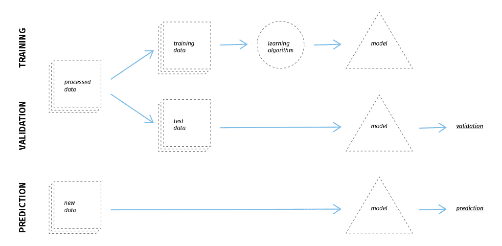
The tools supported two core tasks: creating training data for object detection and validating the models' results.
We looked beyond individual screens to understand how map coders moved through their tasks and where the workflow slowed them down.
Coders worked toward hourly annotation targets, but the effort varied. Real-world objects could be ambiguous, and dense city streets presented different challenges from highways. The tools needed to support that complexity without adding friction.
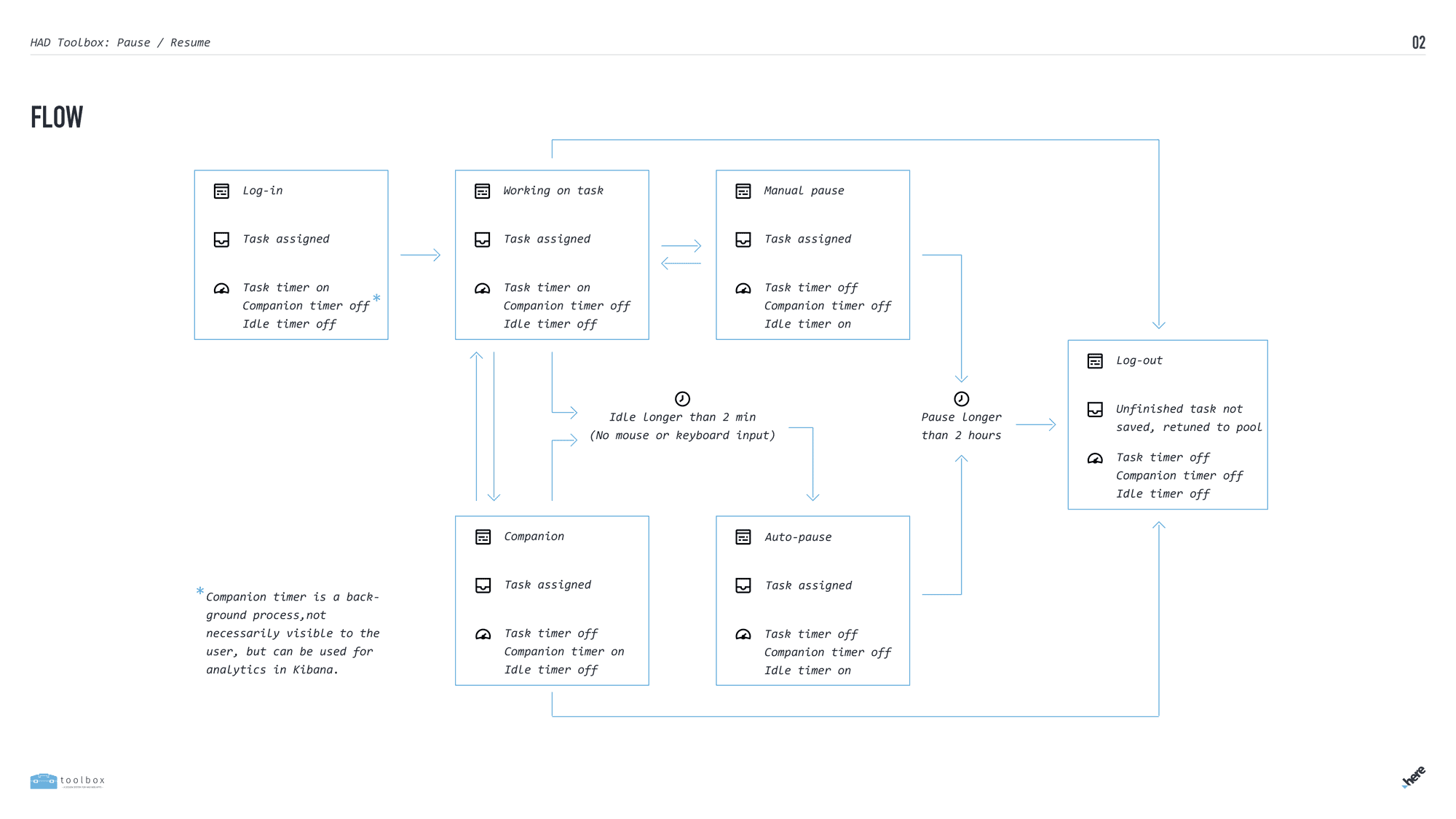
Requirements varied across map objects and data sources, from signs and lanes to satellite imagery, LiDAR, and street-level photos.
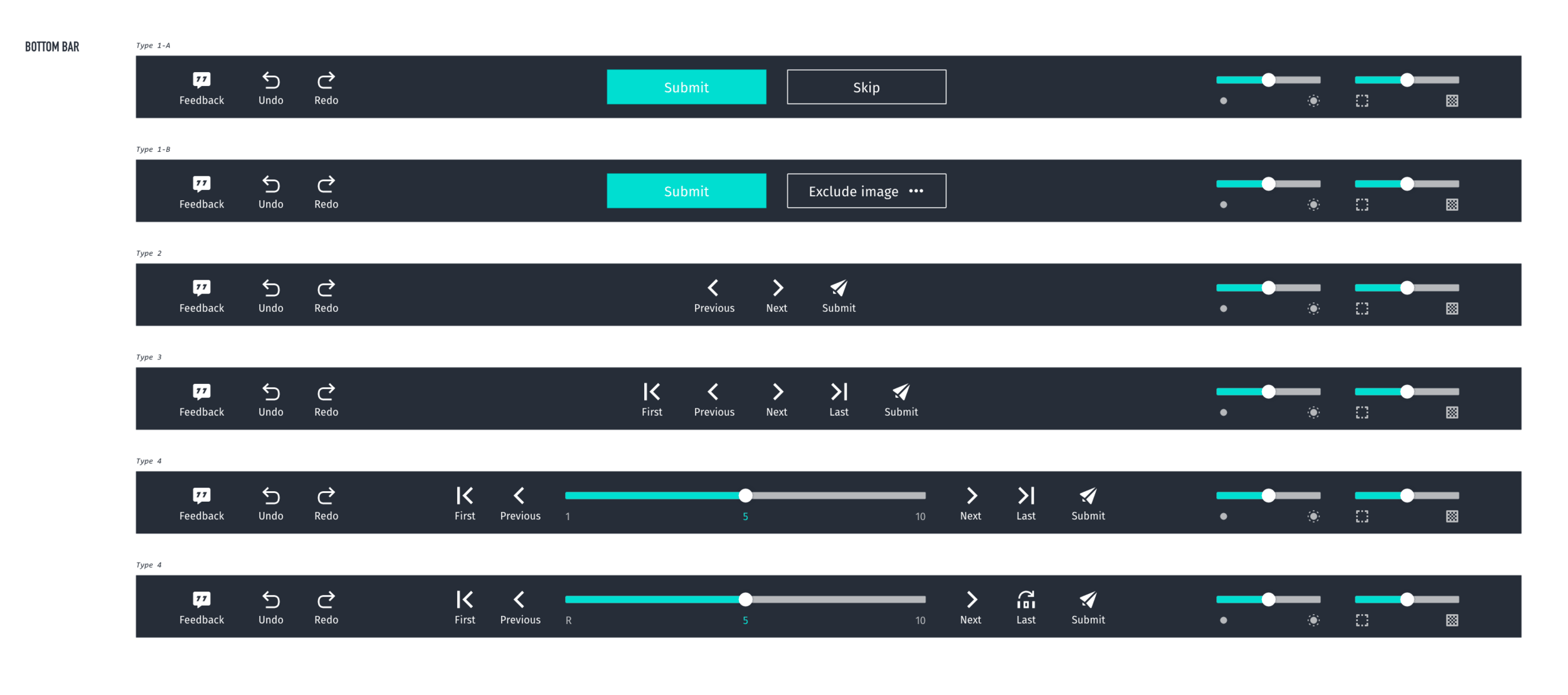
I contributed to a shared design and component system that brought consistency to this growing set of tools. The toolbars above supported navigation between images or tasks, adapting to each tool's workflow.

Cursor specifications for interactions across the tools.
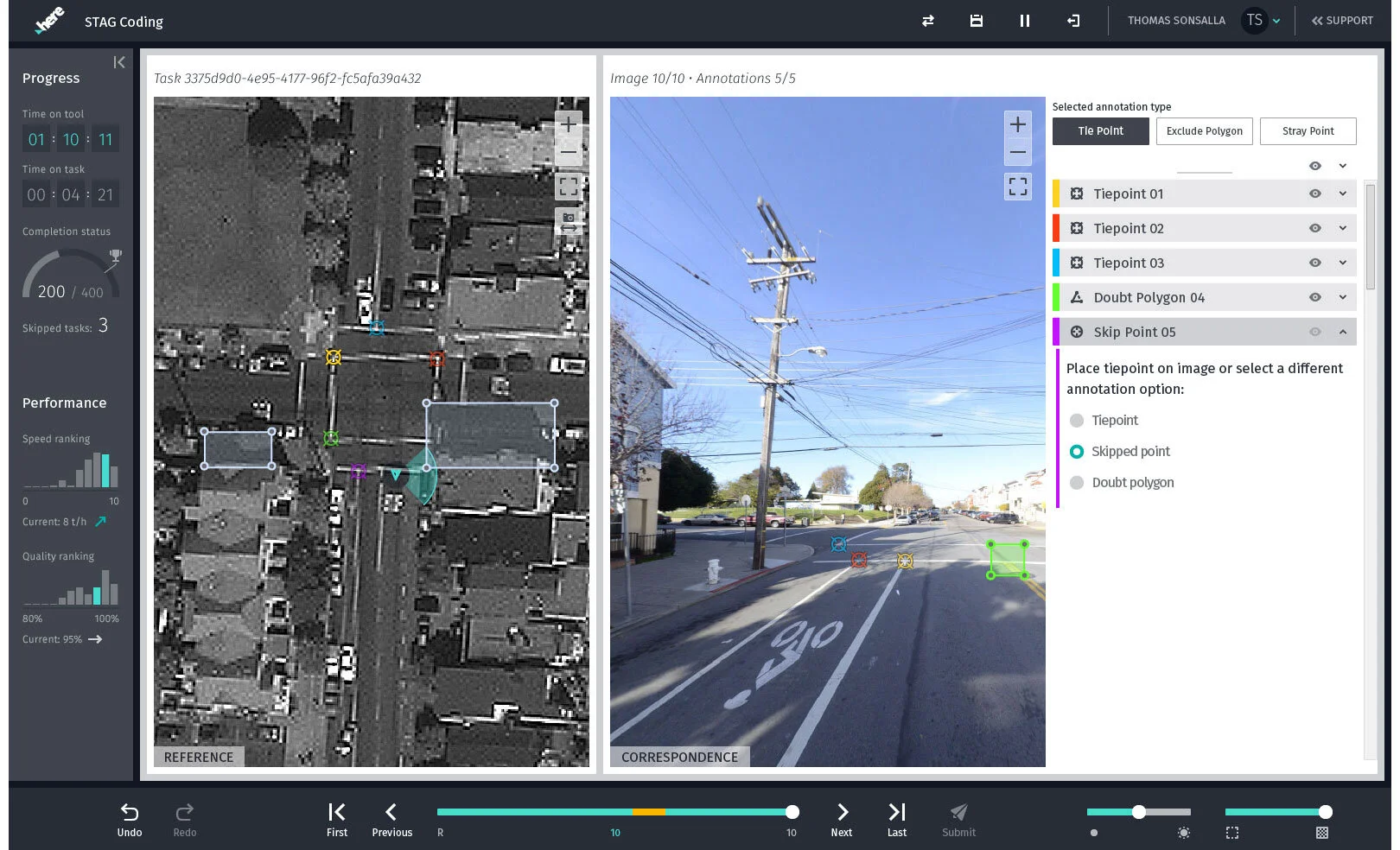


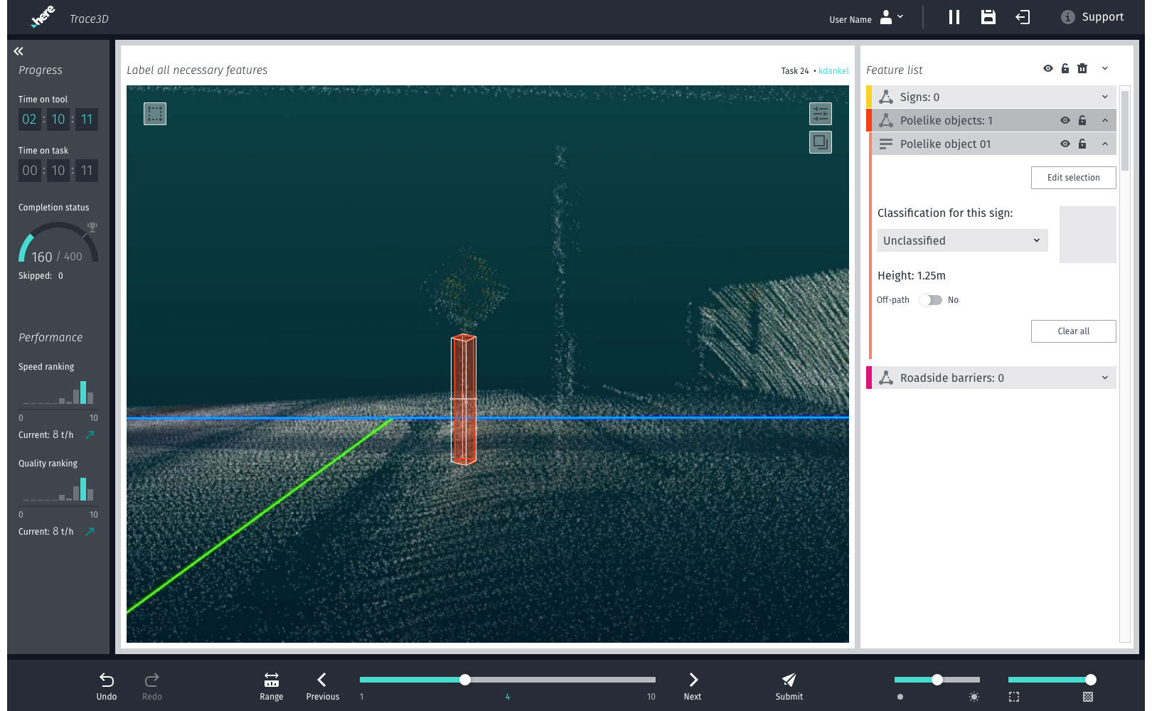
A selection of map-production tools.

Researchers in Mumbai provided feedback on how coders used the tools and where they struggled. Visiting the team let us speak with coders and observe their day-to-day work firsthand, grounding design decisions in the realities of map production.
